Events

DroneCamp 2022

REGISTER TODAY FOR DRONECAMP 2022!

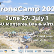
June 27 – July 1 | CSU Monterey Bay and Virtual via Zoom

We are excited to be offering this year’s program in a hybrid format where an in-person audience will be simultaneously viewing the presentations and workshops with a virtual live broadcast via Zoom for those who can’t attend in-person

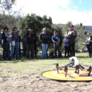
DroneCamp is a collaborative five-day training program that covers everything you need to know to use drones for mapping and field data collection. Now in its sixth year, Drone Camp 2022 will once again provide a unique drone training opportunity designed for a wide range of skill levels and interests, from complete beginners with little to no experience in drone technology, to intermediate users who want to learn more advanced data processing and analysis. Instructors from the University of California and California State University systems will provide workshops and hands-on training. No experience is necessary! Visit the About page for more information.

Be sure to sign up for our email list to be notified of updates by clicking here. If you have any questions please contact info@dronecampca.org. We hope to see you there!
Drone Camp 2021

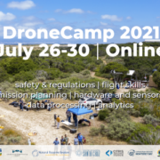
2021 will mark the fifth anniversary of Drone Camp, which was initially launched in 2016 by the UC Agriculture and Natural Resources at UC Davis. Over the years, Drone Camp has evolved into a multi-campus and industry collaborative intensive short course that provides comprehensive training on the use of drones for mapping and data collection. From 2016 – 2019 the 4 day workshop was held on the UCB, UCSD, and UCSC/CSUMB campuses, and in 2020 the workshop was moved online due to COVID-19. Drone Camp 2021 will be a combination of online and in person training as conditions allow.  It is designed for a wide range of skill levels and interests, from complete beginners with little to no experience in drone technology, to intermediate users who want to learn more advanced data processing and analysis.  Instructors from the University of California and California State University systems will provide workshops and focus on the following topics:

  • Flight Skills: Safe Launch and Landings, Basic Operations, Traversing and Avoiding Obstacles, Night Flying
  • Safety and Regulations: Safety and Regulations Overview; How to be a Good Visual Observer; Operating in Controlled Airspace
  • Hardware: Sensors, Platforms and Field Accessories
  • Data Collection: Mission Planning; High Precision Mapping
  • Data Analysis: Stitching Drone Images with Pix4D, Agisoft Metashape, ArcGIS Pro, and OpenDroneMap; Analyzing Processed Drone Data in QGIS and ArcGIS Pro; Advanced
  • Analytics for Vegetation Analysis, Vegetation Analysis and Classification in ArcGIS Pro; Sharing Data and Outputs; Analysis of the Intertidal Zone

These skills are applied across a wide range of applications including:  Agriculture, Land Management, Facilities Inspections, Environmental Monitoring, Forestry, and Research.

UCANR Drone Camp

IGIS is pleased to host the third offering of DroneCamp! This intensive workshop covers everything you need to know to use drones for mapping, research, and land management, including:

  • Technology – the different types of drone and sensor hardware, costs and applications
  • Drone science – principles of photogrammetry and remote sensing
  • Safety and regulations – learn to fly safely and legally, including tips on getting your FAA Part 107 Remote Pilot Certificate
  • Mission planning – flight planning tools and principles for specific mission objectives
  • Flight operations – hands-on practice with both manual and programmed flights
  • Data processing – processing drone data into orthomosaics and 3D digital surface models; assessing quality control
  • Data analysis – techniques for analyzing drone data in GIS and remote sensing software
  • Visualization – create 3D models of your data
  • Latest trends – hear about new and upcoming developments in drone technology, data processing, and regulations

Who Should Attend?

DroneCamp is designed for participants with little to no experience in drone technology, and who are interested in using drones for a variety of real world mapping applications. This training has an emphasis on agriculture and natural resources, but the methods for flight operations, data processing, and analysis are applicable to a broad range of disciplines, including archeology, surveying, and facilities management.

Note the focus of DroneCamp is using drones for mapping, research and data collection. We do not cover building drones, robotics, or videography. Regulations will be discussed but this is not a Part 107 prep class.

Experience with drones or GIS is not required. You do not need to bring a drone. See also the DroneCamp FAQs.

Stay tuned for registration details!