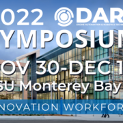
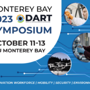
Events

2023 DART Symposium

The 2023 Monterey Bay Drone Automation and Robotics Technology (DART) Symposium will bring together experts and enthusiasts in the field of drone, automation, and robotics technology with entrepreneurs, policy makers, educators and community-based organizations. The symposium will be held from Wednesday, October 11th to Friday, October 13th, 2023, at the California State University, Monterey Bay (CSUMB) University Center. The event will attract a wide range of participants from academia, industry, and government agencies who are interested in exploring the latest advancements in drone technology and its applications.

The Symposium will cover three main topic areas:

  • DART-related Workforce Development
  • Central Coast Innovation Ecosystems
  • Interfacing with the next generation.

The first topic area will focus on how to train and develop the workforce required to keep up with the rapid advancements in drone automation and robotics technology. This will involve discussions on topics such as educational programs, internships, and mentorship opportunities. The second topic area will cover the central coast innovation ecosystems, including companies such as Joby Aviation, Farm N-G, and Advance Air Mobility, and their contributions to the development of drone technology. The third topic area will be focused on engaging the next generation through job fairs, poster sessions, and round table discussions.

Overall, the 2023 Monterey Bay Drone Automation and Robotics Technology (DART) Symposium promises to be a comprehensive and informative event that will provide a platform for participants to learn about the latest advancements in drone technology and its applications. With a diverse range of topics and participants, the symposium is expected to foster collaborations and partnerships that will drive innovation and growth in the field of drone automation and robotics.

2022 Monterey DART Symposium

SAVE THE DATE! Join us for the 2022 DART Symposium on November 30-December 1. California State University Monterey Bay. Mobility, airspace management, carbon-neutral power, and more! Watch this space for keynotes, panels, speaking, and sponsorship opportunities.

2021 Monterey Bay DART Symposium

Join us online and in-person for the 2021 Monterey Bay DART Symposium anchored at the UC Monterey Bay Education Science & Technology (UC MBEST) Center for industry insight panels, presentations, networking, and demonstrations of exciting new age technologies in globally expanding markets. Engage with leaders in these technological arenas, gain a first-hand glimpse into the unique topographical and geographical assets of Monterey Bay, and learn how they can be leveraged to the advantage of your portfolio of companies.

This 3-day event will emphasize uncrewed systems capabilities, focusing on the application of drone technologies in Security (Defense and Homeland Security), Mobility (Advanced Air and Autonomous vehicles) and the Environment (Forestry, Agriculture, Blue Economy, and Climate). With attractive ‘opportunity zones’, Monterey Bay is primed to catalyze innovative organizations and investors in these sectors with broad access to State, National, and International marketplaces.

Drone Camp 2021

2021 will mark the fifth anniversary of Drone Camp, which was initially launched in 2016 by the UC Agriculture and Natural Resources at UC Davis. Over the years, Drone Camp has evolved into a multi-campus and industry collaborative intensive short course that provides comprehensive training on the use of drones for mapping and data collection. From 2016 – 2019 the 4 day workshop was held on the UCB, UCSD, and UCSC/CSUMB campuses, and in 2020 the workshop was moved online due to COVID-19. Drone Camp 2021 will be a combination of online and in person training as conditions allow.  It is designed for a wide range of skill levels and interests, from complete beginners with little to no experience in drone technology, to intermediate users who want to learn more advanced data processing and analysis.  Instructors from the University of California and California State University systems will provide workshops and focus on the following topics:

  • Flight Skills: Safe Launch and Landings, Basic Operations, Traversing and Avoiding Obstacles, Night Flying
  • Safety and Regulations: Safety and Regulations Overview; How to be a Good Visual Observer; Operating in Controlled Airspace
  • Hardware: Sensors, Platforms and Field Accessories
  • Data Collection: Mission Planning; High Precision Mapping
  • Data Analysis: Stitching Drone Images with Pix4D, Agisoft Metashape, ArcGIS Pro, and OpenDroneMap; Analyzing Processed Drone Data in QGIS and ArcGIS Pro; Advanced
  • Analytics for Vegetation Analysis, Vegetation Analysis and Classification in ArcGIS Pro; Sharing Data and Outputs; Analysis of the Intertidal Zone

These skills are applied across a wide range of applications including:  Agriculture, Land Management, Facilities Inspections, Environmental Monitoring, Forestry, and Research.

Monterey Bay DART Meetup – Airspace Management

Many beneficial civilian applications of the UAS have been proposed, from goods delivery and infrastructure surveillance, to search and rescue, and agricultural monitoring. Currently, there is no established infrastructure to enable and safely manage the widespread use of low-altitude airspace and UAS operations, regardless of the type of UAS. A UAS traffic management (UTM) system for low-altitude airspace may be needed, perhaps leveraging concepts from the system of roads, lanes, stop signs, rules and lights that govern vehicles on the ground today, whether the vehicles are driven by humans or are automated.

NASA envisions concepts for two types of possible UTM systems. The first type would be a Portable UTM system, which would move from between geographical areas and support operations such as precision agriculture and disaster relief. The second type of system would be a Persistent UTM system, which would support low-altitude operations and provide continuous coverage for a geographical area. Either system would require persistent communication, navigation, and surveillance (CNS) coverage to track, ensure, and monitor conformance.

This meetup will include presentations on the status of airspace management systems designed and implemented to solve the problems described above. Join us on November 12 to hear presentations on the subject, connect with other professionals interested in the field, and learn about continuing opportunities for R&D, and application. As usual tacos and beverages will be available for a nominal fee.

UCANR Drone Camp

IGIS is pleased to host the third offering of DroneCamp! This intensive workshop covers everything you need to know to use drones for mapping, research, and land management, including:

  • Technology – the different types of drone and sensor hardware, costs and applications
  • Drone science – principles of photogrammetry and remote sensing
  • Safety and regulations – learn to fly safely and legally, including tips on getting your FAA Part 107 Remote Pilot Certificate
  • Mission planning – flight planning tools and principles for specific mission objectives
  • Flight operations – hands-on practice with both manual and programmed flights
  • Data processing – processing drone data into orthomosaics and 3D digital surface models; assessing quality control
  • Data analysis – techniques for analyzing drone data in GIS and remote sensing software
  • Visualization – create 3D models of your data
  • Latest trends – hear about new and upcoming developments in drone technology, data processing, and regulations

Who Should Attend?

DroneCamp is designed for participants with little to no experience in drone technology, and who are interested in using drones for a variety of real world mapping applications. This training has an emphasis on agriculture and natural resources, but the methods for flight operations, data processing, and analysis are applicable to a broad range of disciplines, including archeology, surveying, and facilities management.

Note the focus of DroneCamp is using drones for mapping, research and data collection. We do not cover building drones, robotics, or videography. Regulations will be discussed but this is not a Part 107 prep class.

Experience with drones or GIS is not required. You do not need to bring a drone. See also the DroneCamp FAQs.

Stay tuned for registration details!